Maps, plans and surveys (4)
Ordnance Survey
By Susan Flood


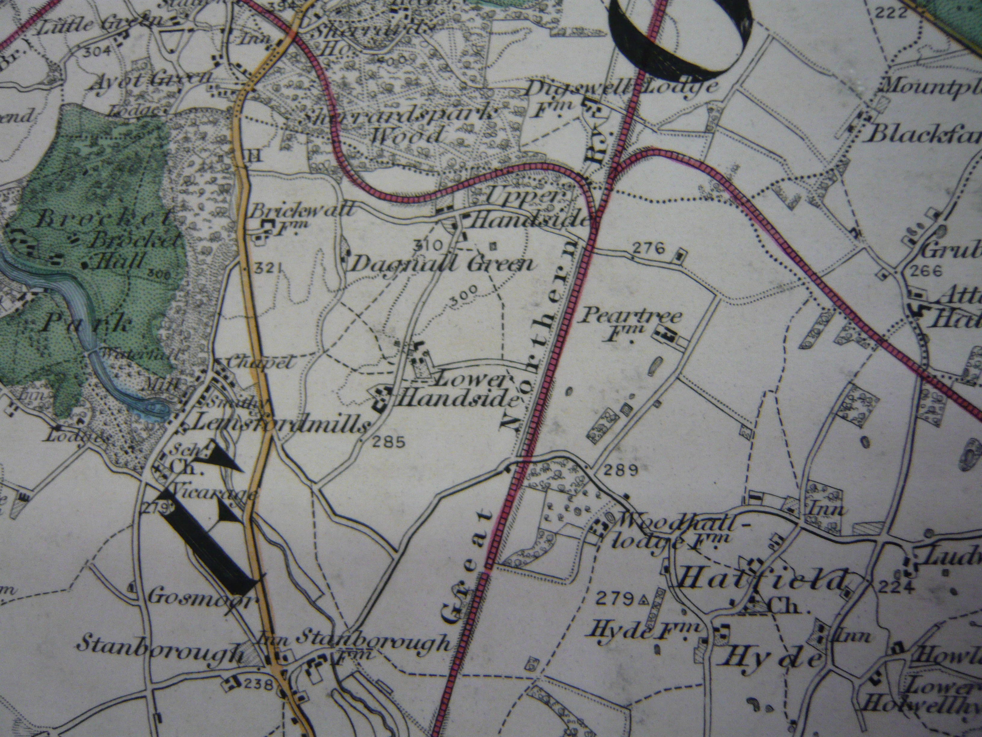
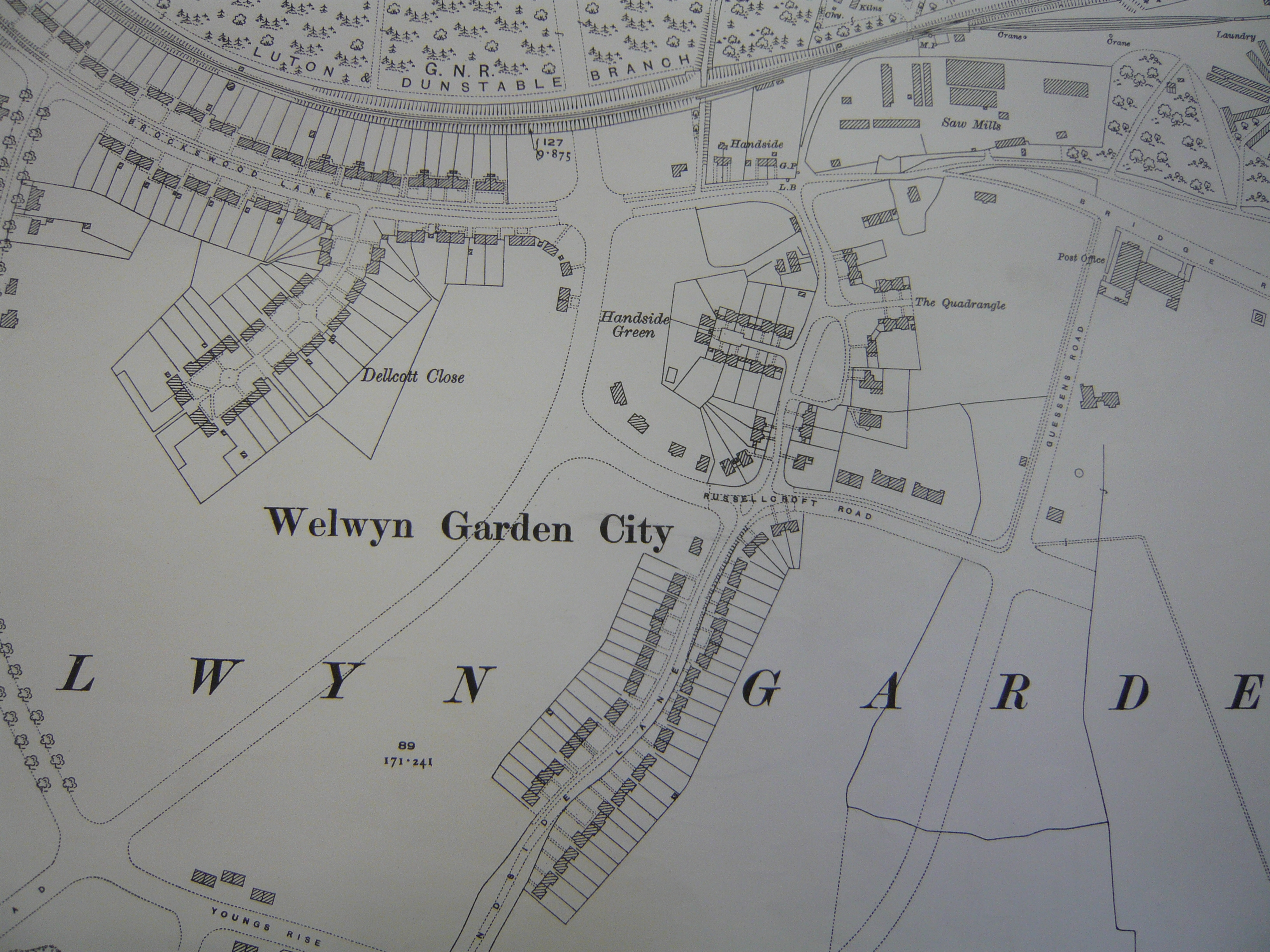
Ordnance Survey: This is the 1 inch to one mile map published in 1887 for the area of what is now WGC. BrocketPark is coloured green, the Great North Road is brown and the railway is red. Many names are given which are familiar to the garden city today such as Handside, Peartree and Holwell Hyde. The Ordnance Survey continued to publish maps roughly every twenty years until the outbreak of the Second World War. The 25ins map of 1923 shows the development that had taken place around Upper Handside.
This page was added on 01/10/2010.


Add your comment about this page